


powered by SignMyGuestbook.com

| Newest
Older Previous Next Random Contact Profile Host |
blizzard warnings - 13:52 , 03 October 2013 heelerless - 21:32 , 18 August 2013 Red Coat Inn in Fort McLeod - 11:38 , 23 June 2013 rushing into the waters - 09:53 , 21 June 2013 choosing a spot - 17:43 , 27 April 2013 |
20 views from the trail
When I decided to hike to Lake Louise in the Fitzpatrick Wilderness last month, I broke a whole bunch of the standard safety rules.
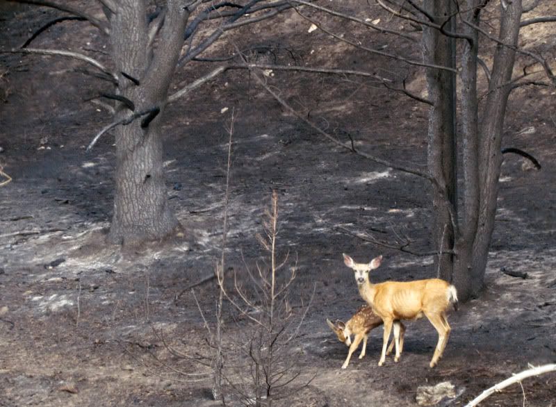
Like, never hike alone. Always tell someone where you're going, and when to expect you back. And in this country, always pack bear spray.
You know, those kinds of rules. And there was one other.
Always know where you're going. Since this was a spur of the moment decision, I did not even have that basic necessity...
A map.
I did have the sense to take some digital photos of a framed topo map of the area hanging in the Mess Hall. Not very helpful if your camera batteries run out, and not very detailed. But it at least let me know which turns not to take.
'Course, I hadn't traveled more than 100m from the trailhead before I realized that topo map was way out of date. And the trail didn't follow that dashed line all the time anymore.
I started off at 13:13, and gave myself two hours to get to the lake. If by 3 o'clock I wasn't within fifteen minutes of the lake, I would turn back.
By two forty-five I was discouraged. I had yet to reach several landmarks near the midway point. Either the trail was way different than that shown on the map, or I was making terrible time.
When I got to a spot clear of trees, I ignored my tiny digital trail map, and took bearings by the landscape around me.
Geez! I should almost be there!
And ten minutes later, I was.
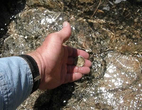
And Sacagawea got a bath, even if it's not Yellowstone waters.
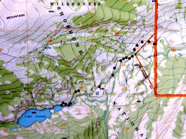
Now, if all works well, and I got all my coordinates right, you can see twenty views I enjoyed on that hike, on the same map I used. Just click on the black spots...
Enjoy.