


powered by SignMyGuestbook.com

| Newest
Older Previous Next Random Contact Profile Host |
blizzard warnings - 13:52 , 03 October 2013 heelerless - 21:32 , 18 August 2013 Red Coat Inn in Fort McLeod - 11:38 , 23 June 2013 rushing into the waters - 09:53 , 21 June 2013 choosing a spot - 17:43 , 27 April 2013 |
sagebrush tour
The agenda said the busses would depart on Thursday's day-long field trip at "07:00 sharp!"
And many of us believed them.
In truth, the busses didn't arrive at the county fairgrounds until almost twenty after seven. Seems they had come all the way from Salt Lake, and been guided to the motels where most of the conference people were staying, rather than the meeting site.
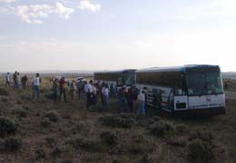
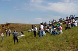
But we loaded quickly, 150+ people, and headed out.
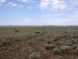
First stop was just a few miles south of town, in the wyomingensis sage, a habitat so similar to most of my own. It was on a narrow paved highway, and quite impressive to see our bus driver bail off into the barrow ditch like he was driving a pickup.
Gist of the conversation of the sagebrush experts at this site, in the 6"-9" precip zone?
They wouldn't treat it. No burning, no chemical sprays. Contrary to the desires of some in our outfit, particularly those who put on this workshop. Contrary to the misconception that eliminating the sage will bring a flush of grasses and forbs. If you burn off the sage in this precip zone, that's all you have.
No sage.
Maybe for 70-100 years.
And no more grass than before, no more forbs, no more ground cover. And will likely lose the "crust" over the desert soil, the lichens and mosses that form a rime on the undisturbed soils, which is what keeps them from washing away.
Cool. So some of us have been fighting the good fight.
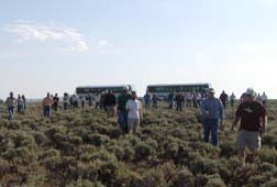
Stop #2 was also in Artemisia tridentata wyomingensis, but a higher elevation, higher annual precipitation, and at the edge of a backfire lit to control a wildfire about three years back. A good chance to compare the burned vs unburned habitats.
Felt like being in a herd of cattle, people pouring out of the busses to head to the flagged stake out in the sage:
Each stop on the tour had a series of speakers, but at each stop there were also people breaking off in twos or threes to have their own conversations and inspections. Often some of the most informative stuff of the whole tour.
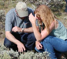
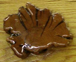
Again, the sage stand at this site was considered to be in good shape by most the experts, without need for burning. One of the out-of-state experts went off immediately to the side and used his pocket saw to hew down a typical sage plant. And counted the rings, as he brushed off the dozens of ants protesting the destruction of their aphid ranch.
Roughly 40 years old. And yes, you count the rings in sagebrush just like you would a tree.
The edge of the recent burn was quite obvious.
As predicted by the "pro-burn" advocates, the burned area was considerably more lush, more densely vegetated and, according to the elk (based upon the quantity of elk droppings), more palatable. Winterfat (Eurotia, a highly favored winter food of both pronghorn and domestic sheep) was doing well in the burned area. So well that one of our habitat folks, who measures this plant frequently, didn't recognize it in its unbrowsed form.
But no new sagebrush plants yet.
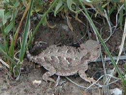
Horny toads, my favorite herp, were found in both burned and unburned areas, although significantly easier to photograph in the burned zone.
We also found a brood of chicks in the burned grassland. When queried, I had to admit I had no idea what they were.
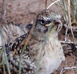
But was relieved to find the state's number one expert birder (the redhead six pictures up) didn't know what they were either. After inspection of the photo, the yellow chin makes me guess they were horned larks. Now probably the most photographed horned larks in the state.
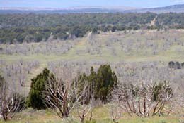
Stop #3 was an overlook over the 2000 wildfire.
Have to compliment the organizers for providing a speaker and microphone system. Made presentations easy to follow.
Basic point at this stop?
Proper grazing management (as in, making sure there is at least some vegetation left to cover the ground when the cows leave) and some smaller prescribed fires (which replaced hard-to-burn sagebrush with stands of flammable grasses and forbs) gave the 2000 wildfire all the fuels it needed to roar across the valley. Basically, in the photo above, where you see green trees it didn't burn, where there are no trees, it did.
Net effect?
Juniper trees, which had been encroaching out into the sagebrush flats (a bad thing for sage grouse) have now been burned back and are pretty much only left in the rocky places that would not carry the fire.
This point was made earlier in the workshop... the lovely old limber pine that I have mentioned before is there on its isolated limestone ridge not because limber pines like limestone, but because the bare rocky areas are the only places a tree could survive for hundreds of years without sooner or later getting burned up in a range fire.
See? Learn something every day, it seems.
'Course, there's no sage left in the burned areas, so the sage grouse are still screwed. If there were any around, their chicks could take advantage of the Crepis, a dandelion-like plant, growing in the burned areas, a favored food for sage grouse chicks that need lots of protein in their diet.
It was about at this point that I felt the sun beating down on my neck, cheeks and ears. And applied sunscreen. But the rosy red sheen and tingle on my face when we got back told me it was too little, too late.
Stop #4 was where A. t. wyomingensis blends into A. t. vaseyana var. pauciflora, also known as mountain big sagebrush. With a spattering of black sage (A. nova).
It was also the lunch stop.
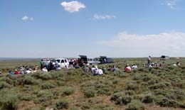
Lunch was the usual standard for these types of desert trips. Sandwiches (premade in this case, which sped up the process, with your choice of beef, ham or turkey), potato chips, apples, bananas, oranges, and cookies (raisin or oatmeal... I passed). People just naturally formed a line at the pickup with the grub, which really, as we discussed in line, is not the most efficient manner of distributing the resources. But it worked, with small groups heading out to dine and mingle in the sage.
(Most of the discussion in our little group dealt with the pros and cons of digital photography over film photography, if you care.)
Post-lunch exercise was to practice identifying subspecies of sage using a black light.
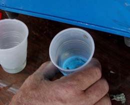
Under long wave UV light, the crushed mountain sage sample fluoresces blue in water, the wyomingensis does not.
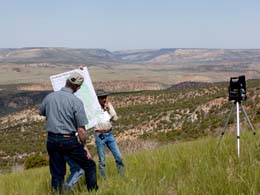
Also practiced running vegetation transects using a methodology employed by Utah folks for over 20 years.
That's A. t. wyomingensis and A. nova at the close end of the transect, and mostly A. t. vaseyana var. pauciflora at the far end.
Of course, you saw that right away, right?
Got so much to say about these transects that I think I'll have to make it an entry of its own. But as we separated into two groups to run the transects, and a thunderstorm rolled over, it occurred to me that we could lose half the sagebrush expertise of three states with one lightning stroke.
'Course, we didn't.
Stop #5 was considerably farther to the south. As we loaded our bus, we found out how the drivers occupied their time while we crawled around in the sage.

Ours had been watching Independence Day.
But our movie viewing was soon interrupted by our tour guide, a fire bug from the local federal agency, describing the habitats and management of areas we were driving through. Parts of our state I had never seen.
A quote from his narrative:
"That there where the sun is shining is Utah."
"We don't worry about that."
He got positively giddy when someone spotted a smoke plume, presumably from a lightning strike from the storm that passed over us, on the mountain above. But to his disappointment, it went out. Apparently on its own.
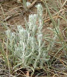
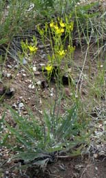
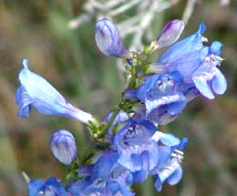
Stop #5 was in what we call the P-J. Pinon-juniper habitats. First was an area where junipers were encroaching into the sage, destroying any hope of sage grouse using the area. The hot discussion the organizers hoped to spark on intentional burning in these habitats never materialized, to their visible disappointment. Almost all agreed the juniper needed to go. Was still a good place for finding new plants, like this species of penstemon.
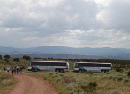
A 0.4-mile hike up an easy road, and we were at stop #6. The same P-J, but where a wildfire had burned through nine years before.
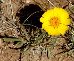
Again a favored place for elk, but not much regrowth on the sagebrush. And again, some new plants.
The Utah bus drivers made no complaints about taking their big rigs out into the scrub, whereas our local companies had refused. And they were close to home, since those far mountains are Utah.
And that was it. We backtracked back to town, rather than making a scenic loop around Flaming Gorge, and got in an hour earlier than anticipated. No movie on the return trip, but a fair number of people caught up on lost sleep.
Not me, of course, but some people.