


powered by SignMyGuestbook.com

| Newest
Older Previous Next Random Contact Profile Host |
blizzard warnings - 13:52 , 03 October 2013 heelerless - 21:32 , 18 August 2013 Red Coat Inn in Fort McLeod - 11:38 , 23 June 2013 rushing into the waters - 09:53 , 21 June 2013 choosing a spot - 17:43 , 27 April 2013 |
nimby
Recently came across a map of where permits have been issued for wind farms in our part of the continent (so far):
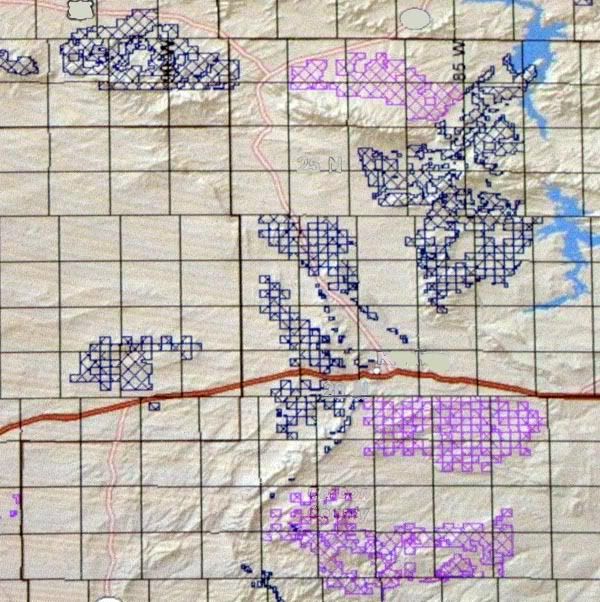
Just to give you a sense of scale, each of those larger black squares is a township. Six miles by six miles. The map is about 60 miles east to west, and over 100 miles north to south.
Over 6,000 square miles (over 15,000 km2). Larger than Connecticut.
We're talking hundreds of square miles of dense roads and forests of white steel. Thousands and thousands of turbines. And naturally the places they plan on filling with turbines are not the same places that have already been ravaged for gas and oil.
Nor uranium, either, which has reared its glowing head again in recent years.
I have to shake my head when I read news reports of citizens complaining about plans for a few dozen wind turbines near their towns.